

Explore Our Offerings
Explore our range of services designed to help you move forward with confidence.
Imaging Quality. Precision. Creative Versatility.
From cinematic aerial storytelling to specialized thermal imaging, our fleet combines versatility and advanced technology to meet a range of project needs.
ADVANCED TECHNOLOGY. ELEVATED CAPABILITIES.
THE CLOUD 9 FLEET
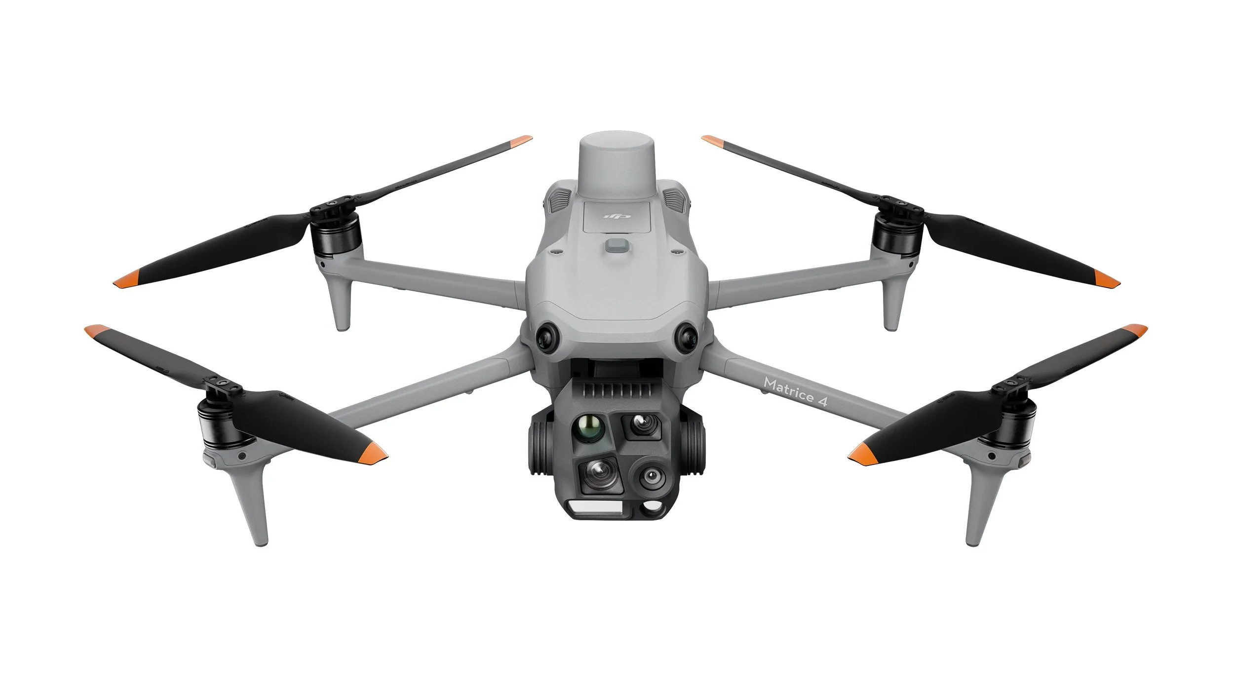
The DJI Matrice 4T is CLOUD 9's most technically specialized aircraft. It combines multiple visible-light cameras, thermal imaging, near-infrared illumination, and laser rangefinding.
Key technical capabilities
Feature Manufacturer specification
Wide-angle camera 48MP, 1/1.3-inch CMOS, 24mm equivalent
Medium telephoto48MP, 70mm equivalent
Telephoto48MP, 168mm equivalent
Thermal camera640 × 512 radiometric sensor
Thermal high-resolution mode Up to 1280 × 1024 output
Thermal temperature range−20°C to 550°C across two gain modes
Laser rangefinder Up to 1,800 meters under specified conditions
Near-infrared illumination Supports observation in low-light conditions
Maximum advertised flight time 49 minutes under test conditions
Visible-light video Up to 4K at 30fps
Service applications
Thermal Imaging & Building Assessments
The Matrice 4T detects differences in infrared radiation, allowing operators to visualize surface-temperature patterns that ordinary cameras cannot reveal.
Potential applications include identifying areas for further investigation involving roof moisture, insulation irregularities, solar-panel anomalies, and abnormal equipment heating.
Possible deliverables: Thermal images, radiometric image files, annotated observations, and visual comparison reports.
Thermal anomalies require qualified interpretation and often ground-level verification. The drone cannot independently diagnose leaks, electrical defects, or structural problems.
Infrastructure & Asset Inspections
The three visible-light cameras provide different viewing angles. The 168mm telephoto lens is particularly useful for documenting elevated or difficult-to-access components from a suitable stand-off distance.
Potential applications include roof-condition documentation, exterior building observations, utility structures, industrial facilities, and solar arrays.
Possible deliverables: High-resolution photographs, annotated imagery, asset-condition records, and repeat-visit comparisons.
These are visual assessments, not engineering certifications or substitutes for required physical inspections.
Public Safety & Emergency Response Support
Thermal imaging can help distinguish heat signatures in certain environments, while telephoto imaging and laser range finding can support remote observation and location awareness.
Potential applications include authorized search operations, emergency scene documentation, wildfire observation, and incident situational awareness.
Possible deliverables: Thermal and visual footage, observation imagery, and location-reference information for authorized response teams.
These operations require agency coordination, appropriate flight authorization, privacy safeguards, and trained personnel. Thermal imaging does not guarantee detection of people or hazards.
Construction & Industrial Monitoring
The Matrice 4T can capture broad site overviews and detailed imagery of selected structures or equipment. Its thermal camera adds a separate observational capability where temperature differences matter.
Possible deliverables: Progress photographs, selected thermal observations, asset imagery, and dated site documentation.
The Matrice 4T should not be advertised as providing survey-grade mapping or certified measurements merely because it has a laser rangefinder. The Matrice 4T is DJI's model more specifically oriented toward geospatial surveying and mapping.
Important technical distinction: Thermal versus night vision
The Matrice 4T's thermal camera detects infrared radiation associated with temperature. Its near-infrared illumination supports certain low-light visual tasks. These are different imaging technologies.
The thermal sensor can measure apparent surface temperatures using spot and area measurement tools, but accuracy depends on factors including emissivity, reflected radiation, viewing angle, distance, and environmental conditions.
Best CLOUD 9 positioning: Enterprise thermal imaging, infrastructure observation, and authorized public-safety aerial support.
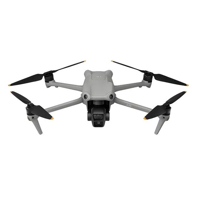
The DJI Air 3 is an excellent primary aircraft for CLOUD 9's creative services. Its dual-camera configuration gives operators both a wide perspective and a tighter composition without physically changing lenses.
Key technical capabilities
Feature Manufacturer specification
Wide-angle camera48MP, 1/1.3-inch CMOS, 24mm equivalent
Medium telephoto48MP, 1/1.3-inch CMOS, 70mm equivalent
Video Up to 4K/60fps standard recording
Slow-motion video Up to 4K/100fps
Color profiles 10-bit D-Log M and HLG
Photography formats JPEG and DNG RAW
Vertical video 2.7K vertical shooting
Obstacle sensing Omnidirectional binocular vision system
Maximum advertised flight time46 minutes
Service applications
Real Estate & Property Marketing
The 24mm camera can capture wide views of properties, landscapes, and surrounding amenities. The 70mm camera offers tighter compositions that help emphasize architectural details or create a more compressed, cinematic perspective.
Possible deliverables include listing photographs, aerial property tours, neighborhood overviews, and promotional video clips.
Commercial Advertising & Brand Promotion
The Air 3's 10-bit recording profiles provide additional flexibility for professional color grading, making it suitable for branded campaigns and polished promotional videos.
Possible deliverables include commercial footage, website hero videos, social media advertisements, and branded aerial sequences.
Construction Progress Documentation
The aircraft can capture repeat photographs of construction sites, development areas, and completed project phases.
Possible deliverables include dated progress photographs, before-and-after comparisons, and edited project-update videos.
Repeatable positioning and framing are important for meaningful comparisons. Standard Air 3 imagery should not be represented as survey-grade measurements.
Events & Venue Promotion
The Air 3 can capture establishing shots of outdoor venues, event spaces, and permitted activities. Its dual cameras provide flexibility for wide scenes and more detailed visual storytelling.
Operations near crowds require particular attention to FAA restrictions and safety. Omnidirectional obstacle sensing does not authorize flights over people.
Best CLOUD 9 positioning: Premium aerial photography, cinematic videography, real estate marketing, and commercial visual storytelling.
Key technical capabilities
Feature Manufacturer specification
Weight Approximately 135 grams
Camera1/2-inch image sensor
Photography12MP
Video Up to 4K/30fps
Lens 14mm equivalent, ultra-wide
Stabilization Single-axis mechanical gimbal plus electronic stabilization
Vertical recording 1080 × 1920 Maximum advertised flight time
Approximately 18 minutes
Flight features Palm takeoff/landing and automated creative modes
Service applications
Social Media & Short-Form Marketing
The Neo is particularly suitable for short, dynamic clips, including business introductions, product promotions, and behind-the-scenes content.
Its automated shooting modes can help capture creative movements with minimal setup.
Small-Business Promotional Content
The lightweight platform can support short visual sequences for storefronts, outdoor business environments, and promotional campaigns.
Possible deliverables include short advertisements, social media reels, and business-introduction videos.
Creative Follow Shots
The Neo can capture certain automated subject-following sequences in appropriate, controlled environments.
This may be useful for outdoor lifestyle footage, promotional storytelling, and selected action sequences.
Confined-Space Creative Filming
Its compact design may make it easier to operate in some smaller areas, but that does not make it inherently safe for all indoor or close-proximity operations.
The original Neo lacks the comprehensive obstacle-avoidance capabilities of larger DJI aircraft. Flights near people, walls, ceilings, and other obstacles require careful risk assessment.
Best CLOUD 9 positioning: Short-form marketing, lightweight aerial video, and creative promotional content.
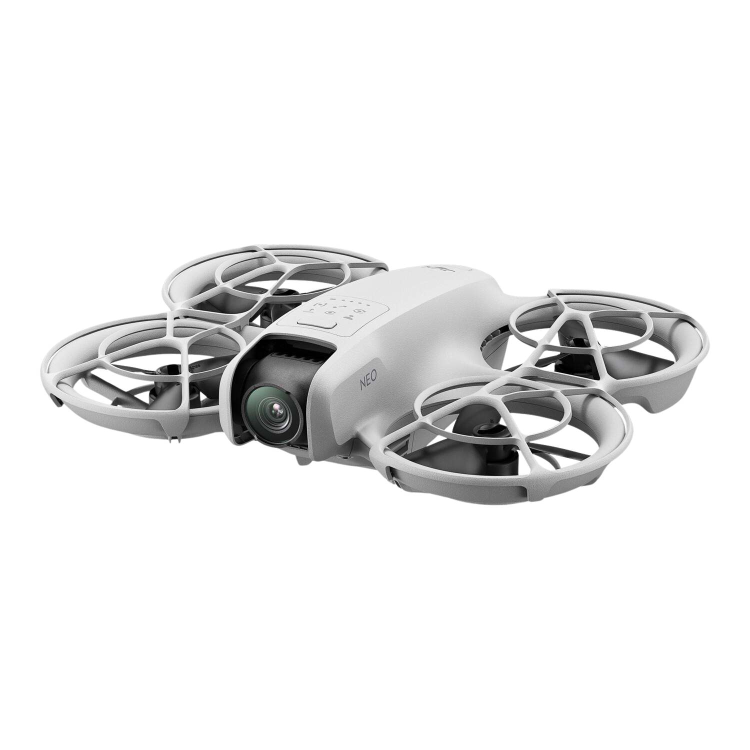
The DJI Neo is the smallest aircraft in your fleet. It offers creative flexibility for lightweight video production, particularly where a large aircraft would be impractical.
“Communication was top-notch and the final outcome was even better than we imagined. A great experience all around.”
Former CustomerGet In Touch
If you're interested in working with us, complete the form with a few details about your project. We'll review your message and get back to you within 48 hours.